Isopolis
Isometric pixel art meets San Francisco's startup soul, one curated stop at a time.
NewName Editorial
Editorial Team


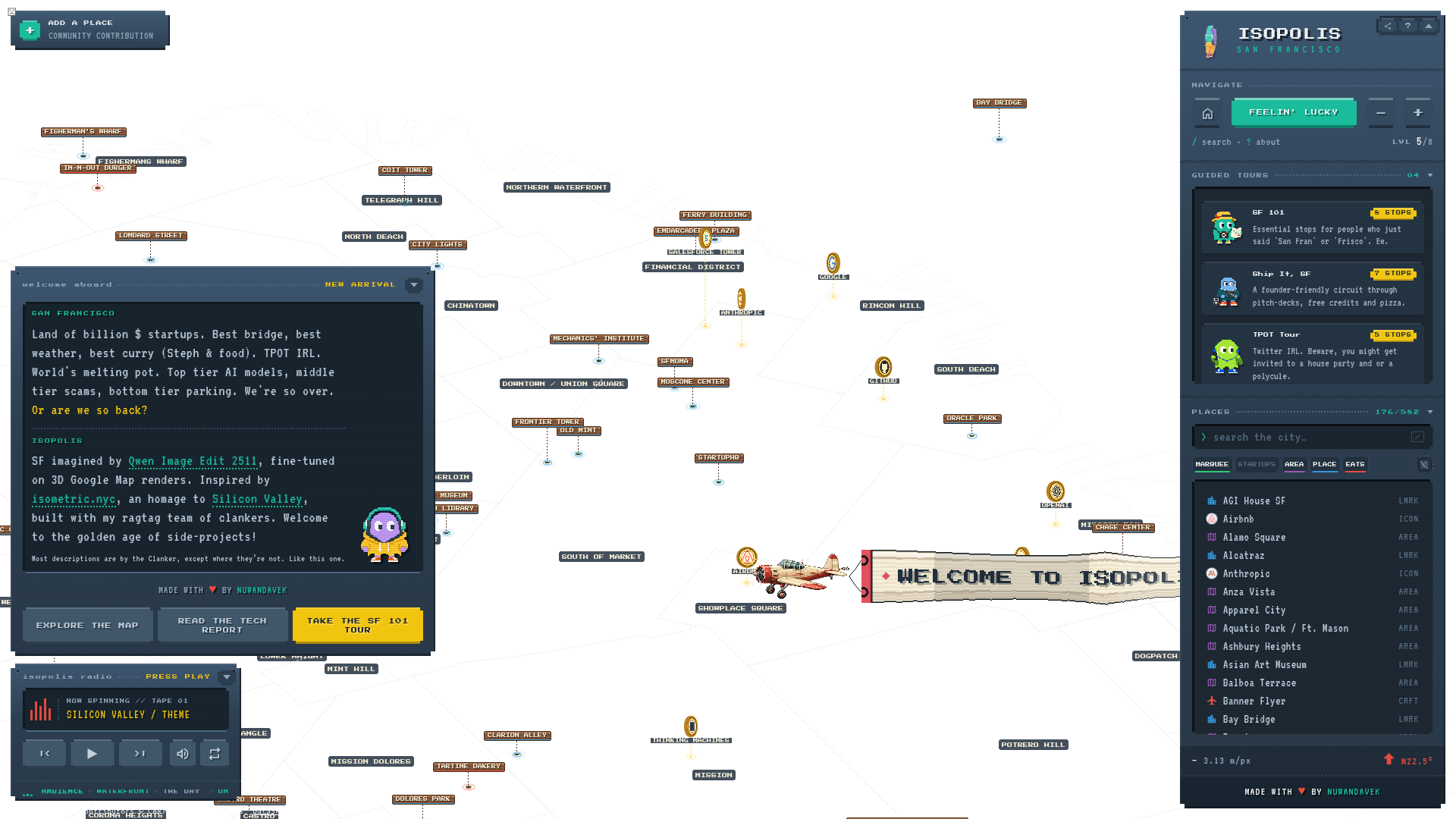
Isopolis is not a map you use to get from A to B. It's a map you open to feel something about San Francisco — the startup lore, the fog, the neighborhoods, the in-jokes. Built as an interactive isometric pixel map, it's part art project, part love letter, and part community bulletin board. The creator, nuwandavek, calls it "SF imagined by Qwen Image Edit 2511, fine-tuned on 3D Google Map renders," and it shows: the city is rendered in charming, slightly whimsical pixel blocks that make familiar landmarks feel like game pieces.
A pixel map with a point of view
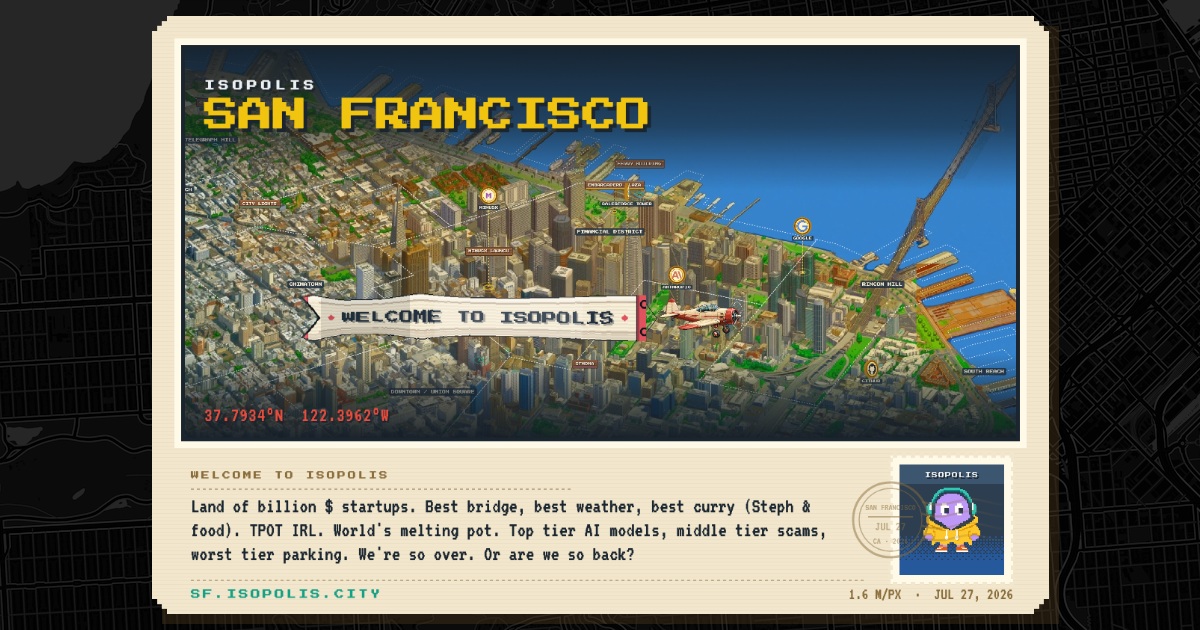
Most maps strive for neutrality. Isopolis does the opposite. The welcome screen greets you with: "Land of billion $ startups. Best bridge, best weather, best curry (Steph & food). TPOT IRL. World's melting pot. Top tier AI models, middle tier scams, bottom tier parking. We're so over. Or are we so back?" That's not a cartographer's copy. It's a resident's inside joke, and it sets the tone for everything else.
The map is dense with markers — 582 places, though only 176 are currently listed. Some are obvious landmarks (Golden Gate Bridge, Coit Tower), but many are cultural touchstones: AGI House, Cerebral Valley, Thinking Machines, StartupHQ. The presence of Y Combinator, Anthropic, and OpenAI as icons alongside In-N-Out Burger and Tartine Bakery tells you this is a map of the city's tech psyche, not just its streets.
The craft of the isometric city
The visual style is the first thing you notice. Isopolis uses an isometric pixel aesthetic — think old-school SimCity or a pixel-art JRPG — but the underlying data is real. The site credits OpenStreetMap contributors and CARTO for the base, and DataSF for neighborhood boundaries. The result is a hybrid: real geography, rendered with a stylized hand.
The "tech report" link hints at the process: the images were generated with Qwen Image Edit 2511, fine-tuned on 3D Google Map renders. That's a clever shortcut — instead of hand-drawing every block, the creator trained a model to translate satellite imagery into pixel art. The output has a consistent, pleasing look, though it's not always accurate to the last alley. But that's fine. Isopolis isn't trying to be Google Maps; it's trying to be a postcard.
Tours as storytelling, not navigation
The guided tours are where Isopolis stops being a map and starts being a narrative. There are four, each with a distinct personality:
- SF 101 (8 stops): "Essential stops for people who just said 'San Fran' or 'Frisco'. Ew." — a gentle roast of tourists.
- Ship It, SF (7 stops): "A founder-friendly circuit through pitch-decks, free credits and pizza." — a startup pilgrimage.
- TPOT Tour (5 stops): "Twitter IRL. Beware, you might get invited to a house party and or a polycule." — a wink at the city's tech social scene.
- Hike-a-thon (10 stops): "Cliffs, ridgelines and several persuasive arguments for good shoes." — a nod to the city's natural side.
These tours aren't about efficiency. They're about vibe. Each stop is a curated choice, and the descriptions are written with a knowing smirk. It's the kind of content that makes you feel like you're being shown around by a friend who's lived here for years and has opinions.
A city that anyone can edit (with a human gatekeeper)
Isopolis invites contributions. The "Add a Place" form lets anyone submit a pin, with fields for name, type, logo, event date, and notes. But there's a catch: "Every entry is reviewed before it appears in Isopolis." A human checks each submission, which keeps the map from becoming a spam-filled free-for-all.
This is a smart balance. The map is open enough to feel communal, but curated enough to maintain its voice. The form even asks if you "work with or represent this place," which adds a layer of accountability. The result is a map that can grow organically without losing its editorial character.
The limits of a one-person labor of love
Isopolis is clearly a passion project. The footer says "Made with ♥ by nuwandavek," and the about section mentions "my ragtag team of clankers" (a playful reference to AI tools). There's no business model visible — no ads, no premium tier, just a "Send a Postcard" feature and a donation-free existence. That's both its charm and its limitation.
The map is delightful, but it's also fragile. It depends on one person's time and interest. The data is current as of the site's last update, but will it stay that way? The community contribution system helps, but the human review bottleneck means growth will be slow. And the inside jokes, while endearing, might not age well for new visitors.
Still, Isopolis doesn't need to be a sustainable business. It's a gift to the city and its culture. In an era of corporate mapping apps and algorithmic feeds, a hand-crafted, opinionated map is a refreshing anomaly. It reminds us that maps can be personal, playful, and full of character. And that's worth bookmarking.